The Inner-State Of GIS


Practical to Tactical
Interstate Engineering is no stranger to Geographical Information Systems (GIS). Our employees have been using the program and its robust capabilities for years. The culmination of years of experience among us to date is well over a century! Despite technology’s enormous advances, our company is dedicated to keeping pace. Our Engineers, Surveyors, and Planners leverage this technology’s capacity to convey and analyze geographic information in many ways. Some of the more practical uses implemented involve preliminary project research and review as well as data incorporations. “I make use of various online GIS programs, as well as set up data for integration into GIS programs during the survey phases of my projects,” said Cody Galloway from our Sundance, Wyoming, office. Just down the road in Spearfish, South Dakota, Curtis Kuenzel is using GIS in practical ways too. “I use GIS for creating and exporting shapefiles, managing georeferenced imagery to overlay projects onto, exporting georeferenced files, and to rectifying imagery,” said Kuenzel, “just recently I’ve been using the software to process drone data.”
The North Dakota team is also using GIS daily. For instance, Paul Bervik in Horace, North Dakota, and Tyler Birchem in Wahpeton, North Dakota, use GIS software for watershed delineation and hydraulic design. Users like Jed Hastings and Darren Peterka from our corporate headquarters in Jamestown, North Dakota, run the gamut of collecting data, storing information, analyzing attributes and data relationships, managing records, and presenting spatial information and geographic data in maps. All in all, Interstate Engineering is helping clients achieve their goals in a more informed and manageable way, and GIS is a daily use tool.
Doubling Down
In early 2018 Interstate Engineering’s leadership concluded that GIS technology was continuing to grow and the firm was going to grow right alongside the technology. “I see opportunities for growth using GIS by being able to have another service that we can supply to clients. Using GIS could open some doors that will allow Interstate Engineering to input the city or county utilities into a digital system so the client and our staff can have access on any electronic device, said Damon DeVillers, Interstate Engineering’s Board Chairman. “We’ll be able to show clients where their utilities are, or they can use the system to find them.”
The desire to grow the company’s GIS services offered an opportunity to hire Jason Boucher, a full-time GIS Specialist. He joined the team in the fall of 2018. Interstate Engineering also invested in more advanced software capabilities, setting the stage for growth. Since the investment three communities came onboard to take part in the technology offerings in web-based deployments of maps and applications. Several other existing clients have shown interest in this growing technology.
Crosby, North Dakota
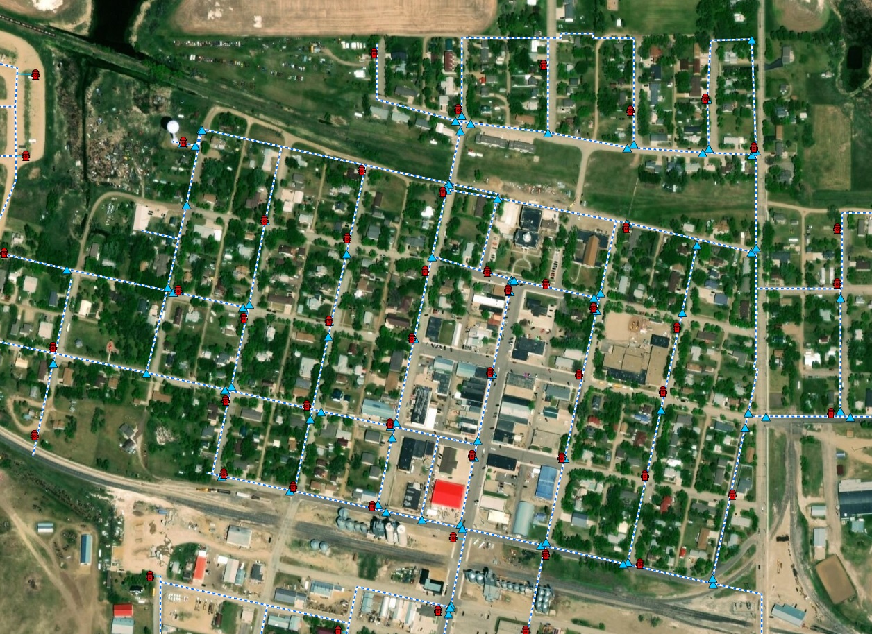
Selected as the City Engineer for Crosby in March 2017, Interstate Engineering’s Teaguean Knudsen and now board president Lonnie Fleck from the Williston, North Dakota, office had been communicating with Dave Allmuth, Water Department Manager, and Jeff Jeglum, Street Department Manager, about implementing a GIS system. The city’s driving force was to understand where their existing infrastructure was located. Having that information as well as basic attributes such as size, type, age, and last maintained dates in a web accessible and device compatible format would save time and resources for city staff. In September 2018 a database structure was finalized and in October work began to collect survey grade data on Crosby’s water infrastructure. Jason and Teaguean collected the data with an RTK, Base, and Rover setup. They surveyed 122 hydrants along with 157 valves. The team is currently connecting the valves and hydrants with water pipeline representations into a GIS. When completed deliverables will include various hard copy maps as well as web-based maps and applications to help field task management. The maps and applications will consist of an online mapping application, a hydrant flow testing tracker application, and a water leak isolation application. As budget allows and the data is compiled, Interstate Engineering will help Crosby gather sewer and stormwater data in similar style and format to view and manage their utilities.
Dry Redwater Regional Water Authority
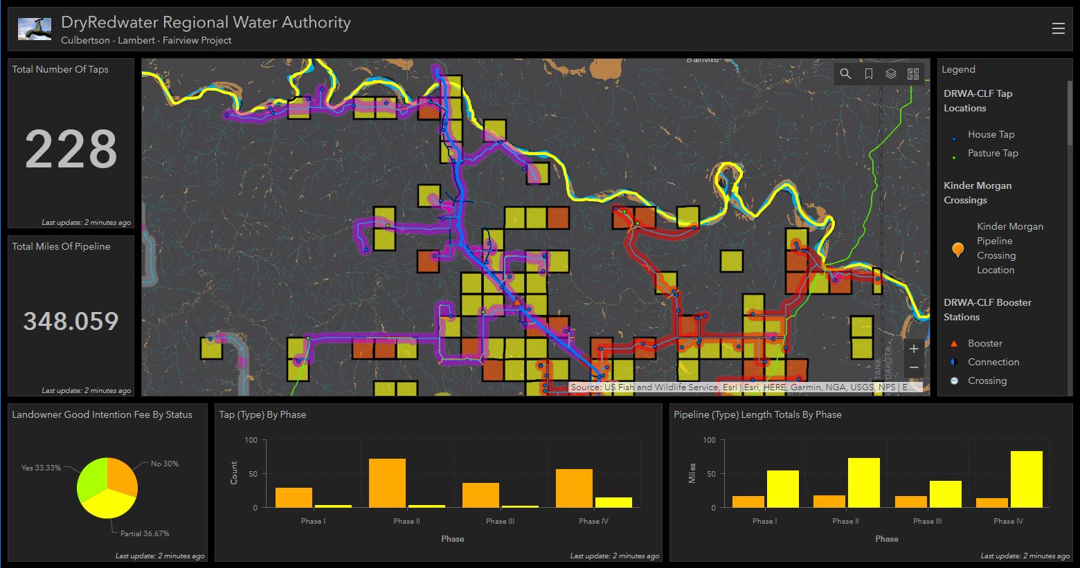
Jordan Mayer of the Sidney, Montana, office worked with the Dry Redwater Regional Water Authority, (DRWA) to develop a scope of work for developing a GIS system. Jason helped create a dashboard, or web-based GIS application, for phased budgeting and construction design monitoring. “This is AMAZING,” said Mandy Nay, DRWA Coordinator, when responding to the initial review of the dashboard. The application brings together several layers of data including project-based design data, with status and quantity information, and environmental, as well as, surrounding private infrastructure datasets. It is all compiled into a manageable dashboard-style presentation that is web-based, with user-friendly widgets that are similar to apps you find on smart devices. Having the system both accurate and user-friendly not only increases the likelihood of use but continues to provide DRWA with the information they need wherever they are located.
Belfield, North Dakota
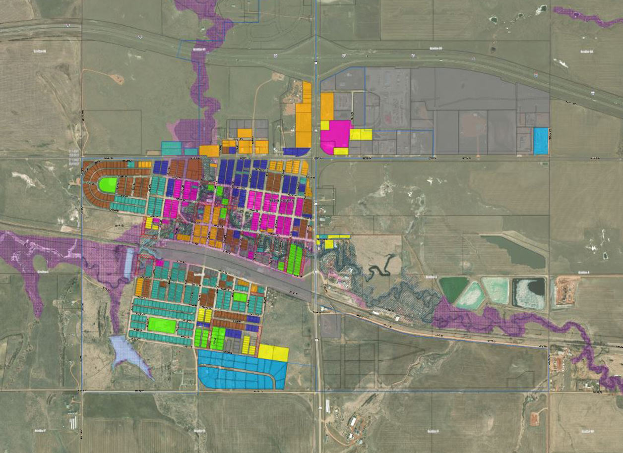
Robert Procive of the Belfield, North Dakota office, paved the way for Interstate Engineering to gain a GIS service provider presence through his relationship with the City of Belfield’s staff and council members. They aspired to take what they had previously done in CAD, (Computer Aided Drafting), formats and relocate the data to a base GIS system that the City can build on over time. Incrementally working as budget allows Jason has built a base GIS database and added the CAD data. He continues, systematically, working to build the database into an accurate representation that can be depicted on both paper-based and web-based presentations for the City of Belfield.
County Water District Billings Heights
Interstate Engineering has begun working with an existing long-term client the County Water District Billings Heights, (CWDBH), to move forward with GIS deployment. The project will consist of GIS software and hardware deployments, schema, and database creation. It will also include web-based mapping and application developments. The district’s assistant manager Peyton Brookshire was the key instigator of the pursuit and had already secured a grant from the Montana Land Information Act, (MLIA) to acquire survey equipment and GIS software to aid in collecting the districts’ infrastructure inventories.
Ranchester, Wyoming
Interstate Engineering has also started working on an “on-call” basis providing GIS services for the Town of Ranchester, Wyoming. Jason was able to identify a unique opportunity for incorporated communities in Sheridan County to allow smaller governments to partner with the county in a shared software agreement. On their own, the small municipalities cannot justify the cost of the software needed for web-based deployments, but under this agreement, they can participate for pennies on the dollar. The contract is for supervision, technical training, and support for the town’s GIS creation and management.
Support Growth
There are many existing clients that Interstate Engineering is currently supporting with GIS services. We look to continue to grow our GIS capabilities and meet the needs of these clients. Likewise, more and more existing clients are starting to pursue proposals from Interstate Engineering on their own accord and are already getting excited to take action towards becoming more GIS aware. The state of GIS is healthy and growing with a bright future for both our company and our clients.
The Inner-State Of GIS Project Team
Teaguean Knudsen – Project Manager
Lonnie Fleck – Project Manager
Jordan Mayer – Project Manager
Robert Procive – Project Manager
Lowell Cutshaw – Project Manager
Brad Boehm – Project Manager
Jason Boucher – Project Manager

